If you’ve ever pored over an old atlas, or traced your fingers from Point A to Point B on an antiquated road map, you might have the same interest that sparked a life-long passion for Henry Wendt. It’s as a result of this passion that the Royal BC Museum is able to present a most unique exhibition Envisioning The World: The First Printed Maps, 1472 – 1700 in association with the Sonoma County Museum.
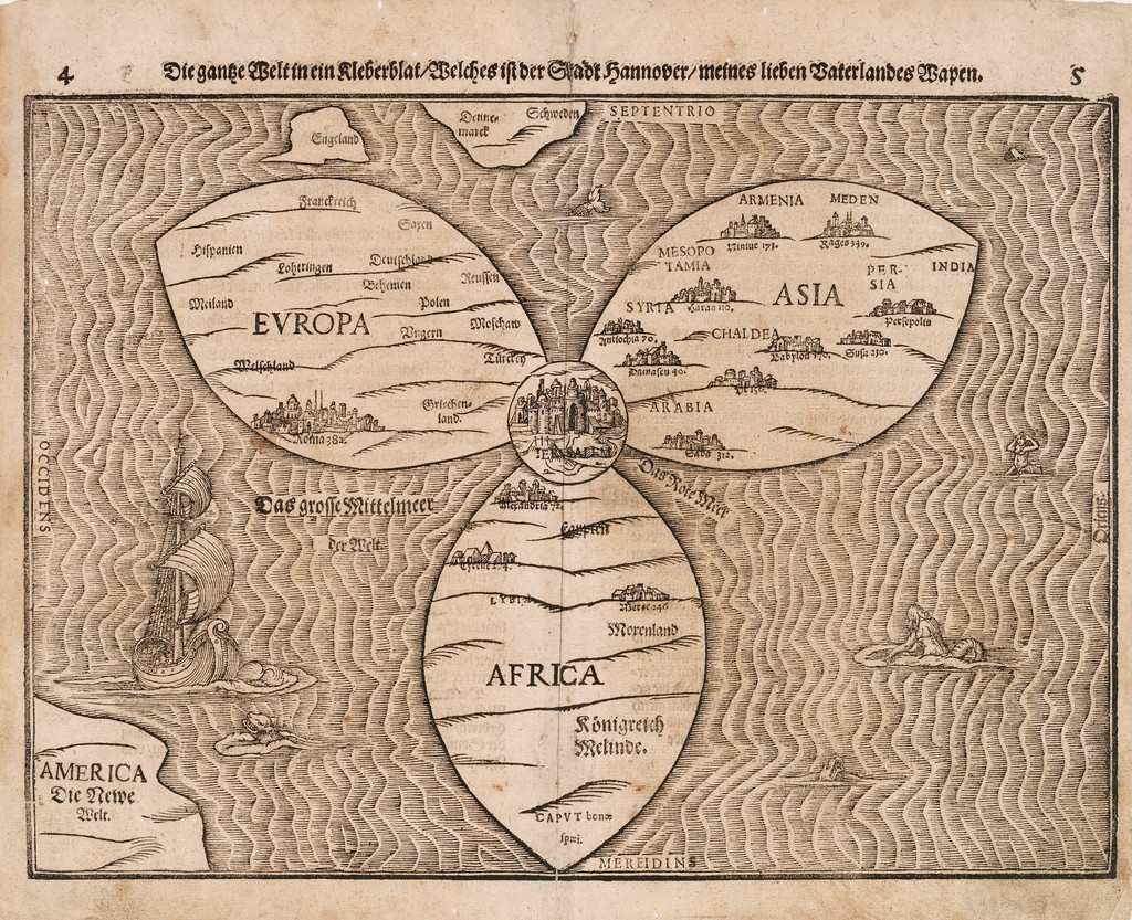 Die gantze Welt in eine Kleberblat, Heinrich Bünting, German 1545-1606.
Used with permission of Royal BC Museum.
Mr. Wendt remembers his first purchase – one that was to set him off on a life time of collecting. He was at the time (in the mid 1960s) travelling on business in Japan and purchased a map at an antiquarian market inTokyo.
Hurrying back to his hotel room, he recounts then spending the rest of the night poring over details, fascinated by what this map revealed.
Mr. Wendt studied history and art history at Princeton, and his interest in maps was as much inspired by the sheer beauty of the illustrations and printing, as it was by the geographic details revealed.
In all, his collection comprises 150 rare and unique maps. Envisioning the World showcases 30. They range from an example of the earliest printed map, to Peutinger’s Table (the world’ oldest printed road map detailling the entire Roman Empire), to a beautifully embellished map based on Ptolemy’s Cosmographica.
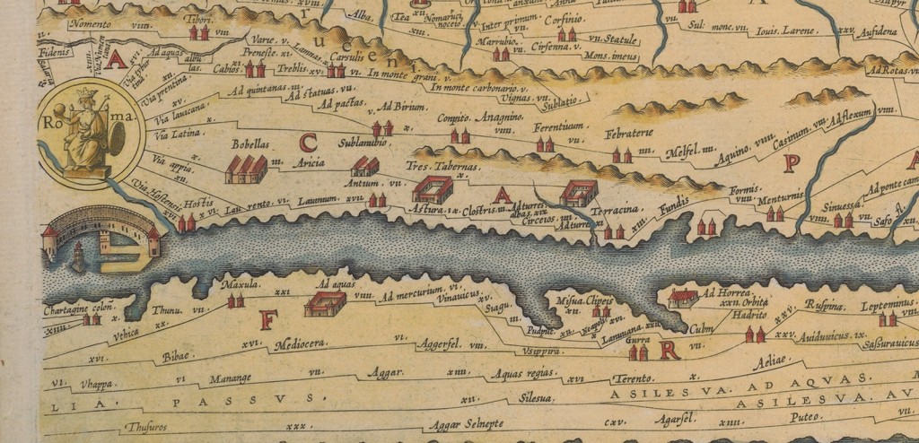 Detail of the Peutinger Table. Used with permission of the Royal BC Museum.
As Mr. Wendt points out, each of these maps qualifies in its own right as a work of art.
Up until the invention of the printing press, maps were labouriously and individually drawn. With the advent of the press in the 1450s, maps were printed and bound into books. Rich families purchased them as a sign of status, but they often stayed firmly ensconced on a library shelf, remaining undamaged, to the benefit of future generations.
“Remarkable leaps in human thought coincide with the emergence of printing, the growth of humanism, and the explosion of scientific discovery beginning in the 15th century” says Mr. Wendt in describing the maps. “They capture magical moments in human understanding”
Lorne Hammond, History Curator, Royal BC Museum, adds “This exhibition reveals the earliest centuries of our exploration of our planet’s geography. The printed maps are a visual feast in which the modern world emerges fro the dialogue between theologians and astronomers, mathematicians and explorers, in masterpieces of cartography. With these maps we begin to truly comprehend the nature of our world.”
Featured in Envisioning The World is a magnificent example from the BC Archives – The Sanson/Jaillot 1696 map which provides a record of how little of the BC coast was charted at the time.
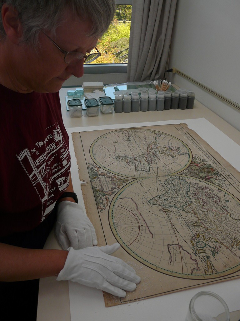 Royal BC Museum staff – restoration of Sanson/Jaillot World Map. Used with permission.
Did you know that the BC Archives, accessible to all, contain a record of over 178,000 maps, atlases and related drawings? If this exhibit inspires you, perhaps you’d like to learn more about the mapping ofBritish Columbia after 1700.
Museum staff have also developed programs to complement the exhibition. They are:
Wonder Sunday For Families: Maps and Memory
Sunday November 25th, 2012 1-3pm
Included with admission or membership
Did you ever wonder how to get there, and how you remember to get back again? Be inspired by the exhibition Envisioning the World, see some of the oldest printed maps in the world and make your own. Wonder Sunday is an interactive, learning-based special event for families that happens on the last Sunday of the month. A theme inspired by museum exhibitions is offered through activities and lively presentations.
Envisioning the World Audio Tour
available at the museum box office for a rental fee of $5
The optional MP3 Audio Tour for this exhibition was created by the Sonoma County Museum, Antenna International and the Royal BC Museum. The introduction by Jack Lohman, CIO, Royal BC Musuem leads into a 17-stop narrated tour. The character voices of Ptolemy, Copernicus, Kepler and Halley help tell their own histories of envisioning the world. In Copernicus’ own words: “Now that it has been shown that the Earth too has the form of a globe, I think we must see… what the place of the Earth is in the universe…” Those interviewed include map collection Henry Wendt and Dan Lewis of the Huntington Museum and Library.
Exhibition Catalogue
Available at the Royal Museum Shop
Hardcover ($60) Softcover ($40)
Envisioning the World: The First Printed Maps, 1472-1700
October 4, 2012 to January 27, 2013
Included in admission to the Royal BC Museum
Admission fees here:
Disclaimer: I attended Envisioning the World as a guest of the Royal BC Museum. I was neither paid nor required to write a review. As always, I retain full editorial control over all content posted on this blog.



Speak Your Mind